- By MARYAM RABIEE
Head of SDGs Today at the UN Sustainable Development Solutions Network (SDSN)
Every location tells a story. And the data behind it provides invaluable insights that can help us understand and solve our communities and planet’s interconnected challenges.
It it no surprise for anyone that nowadays satellite imagery captures information on land use, forest cover, weather patterns, and urban expansion, among others. Also, through remote sensing, changes in ecosystems and the impacts of climate change are being traced and detected—all while geospatial innovations have facilitated the collection and integration of crowdsourced data in mapping the impact of disasters, enabling targeted response interventions, or measuring access to essential services.
Undoubtedly, social media has played an essential role in offering real-time information on environmental and social trends and with the help of machine learning and artificial intelligence, refined data interpretation and enhanced predictions.
But, how do we use all this data and technology to improve the quality of life throughout the planet?
The Interagency-agency and Expert Group on SDG Indicators identified over 20 of the indicatorswhere geospatial data could make a direct or significant contribution. As researchers recognize the potential of Earth observations and geospatial technologies to support decision-making, countries worldwide are increasingly turning toward innovative geospatial approaches to track their progress toward the SDGs.
Government-driven geospatial innovations
Since the adoption of the SDGs in 2015, the need to cultivate capabilities for deploying innovative methods and extracting meaningful insights from geospatial and non-traditional data sources has become more evident.
Efforts have been made by government agencies, the United Nations, and the private sector to promote the use of geospatial information and technologies for the SDGs, while also bridging the gap between geospatial and statistical communities. One such effort is The SDG Geospatial Roadmap which highlights how geospatial data sources and approaches can support the monitoring and implementation of the SDGs. These efforts underscore a commitment to harnessing the full potential of diverse data sources to enhance progress toward the SDGs.
What is happening at a country or city-level?
The United Arab Emirates (UAE) employs satellite imagery to capture urban growth and development patterns at both the national and emirate levels. Night light data plays a crucial role in revealing the story of infrastructure expansion and trends in living patterns and daily activities. Specifically, the UAE Federal Competitiveness and Statistics Centre (FCSC) utilizes night light data to analyze growth in the night lighting area, serving as an indicator of increased urban areas and human activities. Such data supports the measurement of SDG 11.3.1.
In the United States, the Hawaiian government’s Carbon Assessment integrates components from multiple existing mapping efforts to create a new land cover map (CAH Land Cover). The CAH Land Cover employs high-resolution imagery and a hierarchical classification system that facilitates the grouping of mapped units into various configurations. These configurations span from highly detailed plant communities, which reflect current conditions, to more generalized categories encompassing major land cover units and biomes. This classification system provides a comprehensive and adaptable framework for assessing carbon dynamics in Hawaii.
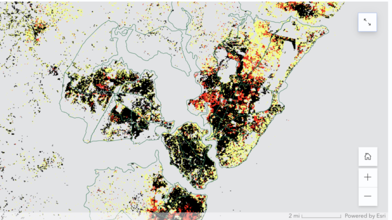
In Africa, the city of Mombasa, in Southeastern Kenya, employs the Degree of Urbanization (DEGURBA) method to identify urban areas designated as open space for public use for all (by sex, age, and persons with disabilities), in alignment with SDG 11.7.1. This approach integrates population size and population density thresholds to categorize a country’s entire territory along the urban-rural continuum.
Digital data-driven reporting on the SDGs
Since 2016, local and national governments of several UN Member States have been encouraged to present Voluntary National Reviews (VNRs) and Voluntary Local Reviews (VLR). These reports serve as platforms for governments to openly discuss their achievements, challenges, lessons learned, and provide updates on their progress toward the 17 Global Goals.
In an effort to enhance innovative multistakeholder initiatives utilizing geospatial data and tools to gauge and track progress on the SDGs, the Sustainable Development Solutions Network’s SDGs Today program collaborated with Esri to develop a digital, data-driven template for Voluntary National Reviews (VNR) and Voluntary Local Reviews (VLR).
Presented in an ArcGIS StoryMap format, this template brings together recommendations from the official UN Handbook with multimedia and geospatial features. National and local governments can leverage this template to disseminate their data in a more accessible format to citizens and the broader SDGs community through interactive and dynamic presentations.
The template underwent review by over 40 official VNR focal points from +20 countries on the sidelines of the UNGA in 2022. Following revisions based on feedback from the representatives, SDGs Today collaborated with the UAE National Committee on Sustainable Development, the Hawaii Green Growth Hub, and UN Habitat to employ the template in crafting digital and data-driven reviews. The outcomes were subsequently presented on the sidelines of the High-Level Political Forum in 2023.
Here are some of the outcomes’ highlights.
The UAE’s 2022 Voluntary National Review
The UAE SDGs Data Hub stands as a testament to the country’s innovation and leadership in monitoring progress, tracking policies, and highlighting local and national case studies relevant to the global goals. The digital VNR developed by the UAE offers a comprehensive snapshot encompassing updates from the SDGs Data Hub, initiatives, and policy development across all 17 SDGs.
“In our pursuit of the SDGs and beyond, the UAE firmly believes in the power of digital data-driven reporting and government-driven geospatial innovations. We recognize that the success of the 2030 Agenda relies on high-quality, timely data for informed decision-making, with a special emphasis on Earth observations and geospatial technologies,” said His Excellency Abdulla Lootah, Deputy Minister of Cabinet Affairs for Competitiveness and Experience Exchange, and Vice Chair of the UAE National Committee on the SDGs. “The Digital Story Maps by SDSN and Esri stand as powerful global tools, seamlessly integrating inclusivity and transparency into the narrative of sustainable development. Beyond merely informing progress, these tools catalyze dialogue, collaboration, and shared learning,” he stated.
Learn more about the UAE’s VNR here.
Hawaii’s 2023 Voluntary Local Review
Data from the Aloha+ Challenge Dashboard is featured in the digital VLR, offering real-time updates on the state of clean energy, natural resources, solid waste, and other sustainability indicators.
“Hawaii’s use of geospatial data and visualization in the VLR, the first such statewide in report in the United States, is helping to advance the SDGs through a unique localized framework,” said Celeste Connors, Executive Director of Hawaii’s Green Growth, and Co-Chair of the Local2030 Islands Network. “Hawaii’s commitment to local goals, culture and community is reflected through the Aloha+Challenge Dashboard, where technology converges with a commitment to traditional wisdom and transparency, demonstrating the transformative impact of data in shaping a sustainable and equitable future,” she mentioned.
Mombasa’s Voluntary Local Review
UN-Habitat, in collaboration with the Western Indian Ocean Marine Science Association (WIOMSA) and local stakeholders from Mombasa, Kenya, implemented the Urban Monitoring Framework(UMF) in the city to present a snapshot of the city’s performance.
This involved computing statistics for various indicators, identifying gaps, and formulating policy recommendations tailored to coastal cities. The initiative serves as an exemplary model for cities seeking to apply the UMF to monitor their performance and prepare VLRs. UN-Habitat’s digital VNR presents UMF indicator data aligned with the SDGs, accompanied by geospatial visualizations of SDG 11 data.
“The urban data ecosystem has recently made huge strides, particularly with innovation and opportunities presented by the geo-spatial technologies. Many cities are now able to monitor their spatial development dynamics against SDGs and also able to report their performances,” said Dr. Robert Ndugwa, Chief Data and Analytics Section at UN-Habitat.
Way Forward
As we continue to delve into the dynamic realm of geospatial innovations and their pivotal role in advancing SDGs, a concerted effort towards capacity building is essential. That is why governments, civil society organizations, the private sector, and other stakeholders should actively engage in knowledge-sharing initiatives, fostering a global community equipped to harness the full potential of geospatial innovations.
The digital era has brought forth new avenues for reporting progress on the SDGs. The digital, data-driven template can be used as a step in this direction to enhance data accessibility, transparency and accountability. The journey towards sustainable development is a collective one, and geospatial innovations stand as a powerful ally in shaping a more resilient and equitable story of the future.
Read more:


